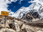
Day 1 - Kathmandu: Arrival Day
Elevation: 1350m/4428ft
Welcome to Nepal and the start of our adventure! One of our Airport Representatives will be on hand to greet you when your plane lands and transfer you to your hotel in Kathmandu. We'll have a final briefing in the evening and then turn in early in advance of a big day tomorrow.
Day 2 - Kathmandu to Besisahar
Approximate Time: Driving (7 to 10 hours)
Elevation: Besisahar 820m/2700ft Driving (7 to 10 hours)
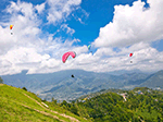
We have a lengthy drive today from the capital to Besisahar as we come nearer to the trek's physical starting point. You'll catch your first glimpse of snow-capped mountain scenery today!
Day 3 - Besisahar to Syange to Chamje
Approximate Time: Drive (1 hour) and Trekking (5 to 6 hours). 8 Km Hike/5 miles
Elevation: Chamje 1385m/4540ft
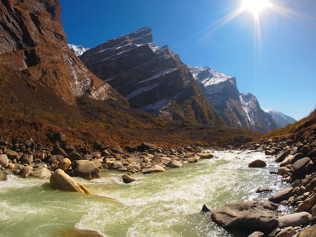
This is it! We leave Besisahar bright and early and drive to Syange, where we'll take the first, easy stroll of the journey. It's downhill and steep to start, as we head in the direction of Bahundanda. The sight of a roaring waterfall is our cue to cross over the Marsyangdi River via suspension bridge. The path of the river will bring us initially through the stone village of Jagat before ending the day in Chamje.
Day 4 - Chamje to Bagarchhap
Approximate Time: Trekking (6 to 8 hours). 15 km/9 miles
Elevation: Bagarchap 2160m
We're still following the Marsyangdi as a new day begins, climbing steadily towards Tal, the first village of the Manang district. Beyond that, our trail crosses a wide, flat valley, and then zip-zags up and down towards Dharapani. We'll know we have arrived when we see the chorten, or stone entrance, typical of Tibetan-influenced architecture. The views give way to many flat-roofed homes, set against orchards of apple trees and fields of waving maize. We'll stay the night in neighboring Bagarchhap.
Day 5 - Bagarchhap to Chame
Approximate Time: Trekking (5 to 6 hours). 13km/8 miles
Elevation: Chame 2710m/7090ft
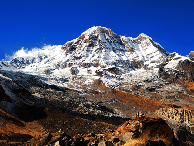
We pass through Tyanja first on Day 5, and then through the forest and parallel to a river on the way to Kopar. Chame, our stop for the evening, is the seat of the Manang district. The people of Chame followed the Nepal-Tibet trade route a long time ago, and settled here. They brought with them the customs and building style of the Tibetans, and have upheld the culture through the centuries. Chame has lovely views of Annapurna II, and is crossed by a pair of burbling hot springs.
Day 6 - Chame to Pisang
Approximate Time: Trekking (5 to 6 hours). 13km/8 miles
Elevation: Pisang 3250m/10660ft
Through the forest, across a steep valley, over a river and some bridges... our path to Pisang is not a boring one! On the way we'll be treated to spectacular views of the soaring Paungda Danda rock face.
Day 7 - Pisang to Manang
Approximate Time: Trekking (6 to 7 hours). 15 km/9 miles
Elevation: Manang 3540m/11600ft
We're moving through the higher, drier portion of Manang, which receives little monsoon hydration due to the natural shield of the Annapurnas. The farmers here breed yaks and raise crops, while taking advantage of special trading dispensations that they've had since the 18th century. We're back following the Marsyangdi as of Mungji village, and then on our way through either Hongde, with a little less climbing, or Ghyaru, which has more picturesque views. Either one will bring us to our guesthouse at Manang.
Day 8 - Manang: Acclimatization Day
Elevation: Manang 3540m/11600ft Rest Day
We'll linger in Manang today for a much-needed acclimatization day. We'll keep our legs stretched with some scenic, peaceful day walks around the sprawling village. Not only will we see the sights, but we’ll gradually adjust to the altitude. At night time, we'll return to our guesthouse to rest up for a steeply-ascending leg of our trek.
Day 9 - Manang to Yak Kharka
Approximate Time: Trekking (3 to 4 hours). 10km/6 miles
Elevation: Yak Kharka 4050m/13290ft
Our trail ascends a steep, dizzying 500m to the Yak Kharka, and then up through the Tenki Manang as we exit the Marsyangi Valley. Continuing along the Jarsang Khola Valley, we reach Yak Kharka at 4,000m. As the name suggests, there are a lot of yaks here! The vegetation grows sparse, however, as we continue to hit higher altitudes.
Day 10 - Yak Kharka to Thorong Phedi
Approximate Time: Trekking (3 to 4 hours). 9km/5.5 miles
Elevation: Thorung Phedi 4450m/14600ft
We'll climb high for about two hours before descending slightly to cross the river. It's all uphill again after that until we reach Thorong Phedi. Some of the newest guesthouses of our trek are located here. We'll be up extremely early tomorrow, so a full night of rest is important!
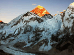
Day 11 - Thorong Phedi to Muktinath via Thorung La Pass
Approximate Time: Trekking (7 to 8 hours). 16km/9.5 miles
Elevation: Muktinath 3800m/12460ft via Thorung Pass 5416m/17800ft
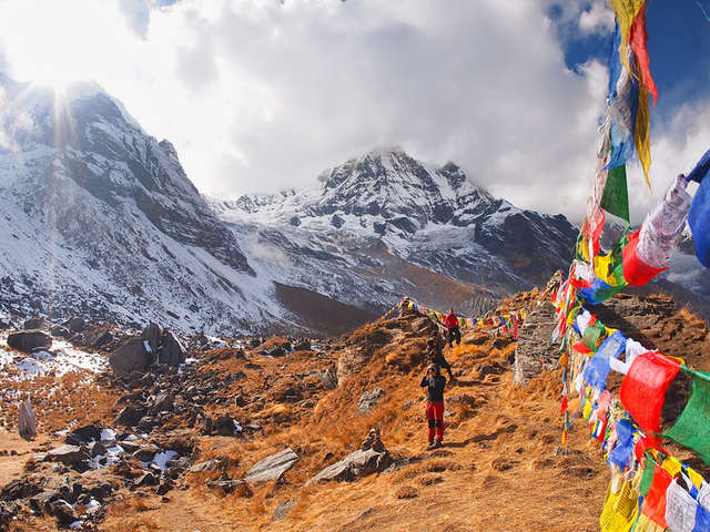
We'll start trekking at 4am today in order to reach the pass before 10am. It's a necessary evil, because if we arrive any later, we'll risk detrimental weather conditions negatively impacting our progress. Considering that we are 5,416m up at this point, the strong winds later in the day can be dangerous! It's a steep climb, but one that it safe and routinely used. Heavy snow can also be a problem. Conquering the foibles of nature reaps rich rewards at this point, however, for the magnificent view from the top of the pass and our arrival in the holy town of Muktinath. The name means "place of Nirvana," and it is said that pilgrims visiting the temple there are relieved of all sorrows. It is a place sacred to Hindus and Buddhists, and filled with fascination and ethereal power. We'll overnight here.
Day 12 - Muktinath to Marpha
Approximate Time: Trekking (6 to 7 hours). 15km/9 miles
Elevation: Marpha 2670m/8760ft
Today we travel the scenic, beautiful trail between Muktinath and Kagbeni, via Jhong. This is a less-frequently traveled leg of the Annapurna Circuit, but one that we feel is richly worthwhile for its outstanding views. There are a number of distinctive homes here, all typical of the sect of mountain people who live here, as well as an old gompa.
Day 13 - Marpha to Ghasa
Approximate Time: Trekking (7 to 8 hours). 20km/12 Miles
Elevation: Ghasa 2010m/6600ft
Marpha at (2960m) is a charming village with many canals and where you can find a variety of fruit. Make sure you visit the big gomba in the city centre. After lunch we will head towards Ghasa a small Thakali settlement with welcoming people and lodges. You will notice on climate as it becomes drier and colder.
Day 14 - Ghasa to Tatoponi
Approximate Time: Trekking (7 to 8 hours). 20km/12 miles
Elevation: Tatopani 1200m/3940ft
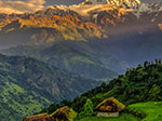
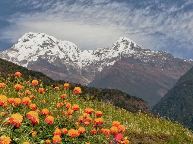
The name "Tatopani" means "hot spring," and that is what today's destination is best known for. The villagers are ethnically Thakali and Tamang, and have enjoyed their home's reputation as a significant trading post between Nepal and Tibet. This Buddhist village has about six hundred homes. Although we are moving up rather steeply in elevation, the walk is enjoyable as we pass colorful villages, gorgeous flowers, and plenty of lush greenery.
Day 15 - Tatoponi to Ghorepani
Approximate Time: Trekking (7 to 8 hours). 15km/9 miles
Elevation: Ghorepani 2870m/9410ft
This is it, believe it or not, the last truly challenging leg of our adventure. We'll pass through sizeable Shikha, watching village children running off to school and farmers working their fields. Ghorepani is a major stop for trekkers doing all varieties of the Annapurna Circuit, and is always bustling with activity.
Day 16 - Ghorepani to Poon Hill, Pokhara
Approximate Time: Trekking (6 to 7 hours). 15km/9 miles
Elevation: Poon Hill 3200m/10500ft
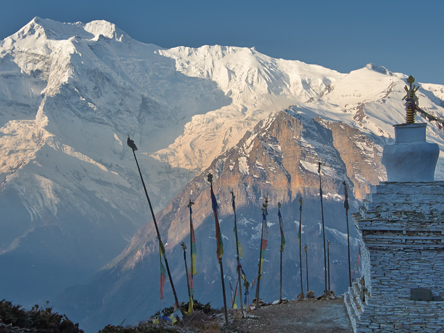
We'll be up before dawn today, but with good reason: our day kicks off with an excursion to Poon Hill and an indescribably wonderful panorama of three Himalayan peaks (Dhaulagiri I, Annapurna I, and Manalsu) illuminated by the glowing rays of sunrise. From here, we'll also be treated to views of the 6,000m-deep Kali Gandaki Gorge and the visual border of Nepal and Tibet as divided by the trans-Himalayan ranges.
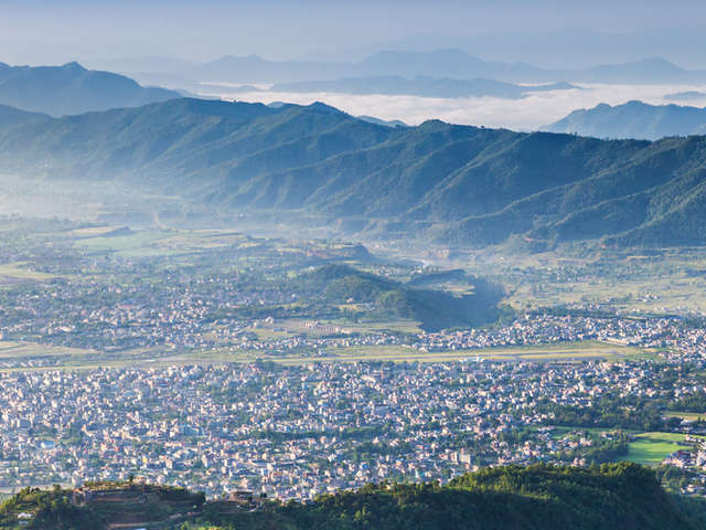
The last walk of our trek is an easy one as we stroll downhill from Tikhedhunga to Nayapul. Here, our trek officially ends. We'll load our tired feet into a taxi and an hour away to gorgeous Pokhara, and a comfy hotel.
Day 17 - Pokhara to Kathmandu
Elevation: Pokhara 1000m/3280ft
We will take an early morning flight to Kathmandu. Enjoy the rest of the day free in Kathmandu. It's our pleasure to take you out for a farewell dinner tonight with the team.
Day 18 - Kathmandu: Departure Day
Elevation: 1350m/4428ft
Today we'll ensure that you get to the airport with time to spare, taking our final leave. Hopefully you have made the kind of memories that will last a lifetime.
END OF OUR SERVICES


 Member")