The short answer
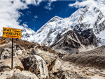
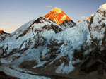
The highest point is the summit of Everest, and the lowest is in the far southeast of the Terai, near Kechana Kalan in Jhapa, at roughly 60 metres above sea level. Nepal packs almost 8,800 metres of vertical relief into about 200 km.
Key facts
- Highest
- Everest, 8,848.86 m
- Lowest
- Near Kechana Kalan, about 60 m
- Width north to south
- Around 150 to 200 km
- Zones
- Terai, mid hills, Himalaya
How it works
- Terai firstWarm, flat and green. Chitwan and Bardia sit here, as do Lumbini and Janakpur.
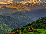
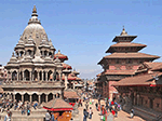
- Hills nextKathmandu, Pokhara and the old towns live at 800 to 2,200 m, where most trips stay.
- Mountains lastAbove about 3,000 m, villages thin out and altitude planning begins.
Insider tip
This is why a single week can take you from a steamy jungle morning to a snowy viewpoint by evening, and why packing for Nepal needs layers rather than one climate.
Avoid this
Do not assume the weather in Kathmandu tells you anything about the mountains; ask for the forecast at the altitude you will actually be sleeping.
Related questions
Is Nepal all mountains?
No. Roughly a fifth of the land is Terai plain along the Indian border, and most of the population lives in the hills and plains rather than the high Himalaya.
Why does the climate change so much?
Because the land rises so quickly. Every 1,000 m of height cools the air by several degrees, so short journeys cross whole climate zones.
Plan your Nepal trip in 60 seconds
Answer four short questions. We show trips that fit, and a planner can send a route and price. Free, no payment.
Trips that match this guide
Keep reading
More guides to explore
- Everest RegionLukla, Namche, mountain flight, helicopter and season.
- Annapurna RegionGhandruk, Poon Hill, Sarangkot, permits and season.
- Nepal Peaks and HeightsNamed peaks, heights and the best place to see each.
- Everest Trail StopsPhakding to Gorak Shep, Gokyo, the passes and glaciers.
- All Nepal guidesBrowse every place and theme.